
METEONAUTICA
Meteorologia Marina
Bollettino dei naviganti nel Mediterraneo
Bollettino del mare valido per le prossime 36 ore e previsioni meteomarine a breve termine (72 ore) sul mare Mediterraneo predisposte dal servizio meteorologico tedesco Deutscher Wetterdienst (DWD) - divisione di meteorologia marina di Amburgo (Marine Weather Service Hamburg).

Il bollettino del mare per il Mediterraneo e le Isole Canarie viene emesso quotidianamente dal DWD alle 12:00 UTC mentre le previsioni meteomarine a 72 ore sono elaborate due volte al giorno di norma alle ore 06:00 e 18:00 UTC tramite modello matematico con modalità simili al bollettino MeteoMare proposto da questo sito addirittura dal 1993. Servirsi dei tre bottoni appositi per selezionare alternativamente la visualizzazione del bollettino del mare o la previsione meteo per il Mediterraneo settore ovest e settore est.
Archivio storico
Qualora occorressero i bollettini per il Mediterraneo emessi in passato dal DWD che al momento non sono disponibili per il download diretto da questa pagine potete richiedere di includerli nella ricerca manuale nell'archivio storico Meteomar.
Per contattare direttamente il Cybernauta: Mailto@cybernauta
Risposte alle domande più frequenti: FAQ@cybernauta
Previsioni per il Mediterraneo
Weather and sea bulletin for the Mediterranean Sea
issued by Deutscher Wetterdienst, Marine Meteorological Service Hamburg
at 26.03.2025, 14.00 UTC.
General synoptic situation 12 UTC:
A high 1017 over Turkey moves slightly eastwards and
weakens. A low 1003 over southern Italy deepens
temporarily and moves slightly northwards. Showers,
thunderstorms and in some areas heavy rain are to be
expected in the central Mediterranean. The ridge of a high
1033 west of the Azores will influence the western
Mediterranean, the Canary Islands and the Bay of Biscay.
Until thursday evening in the following forecast areas strong winds
are expected:
balearic islands
golfe du lion
tyrrhenian sea
adriatic sea
ionian
sea
FORECAST UNTIL THURSDAY EVENING:
Canary Islands:
northeast 4 to 5.
Alboran/Gibraltar:
westerly winds 3 to 4.
Palos (between Southeast Spain and West Algeria):
southwest 3 to 4, at times misty.
Balearic Islands:
north to northwest 5 to 6, later decreasing about 4,
western part light and variable winds, at times shower-
and thundery gusts.
West of Corsica/Sardinia:
first north to northwest 4 to 5, increasing a little, at
times shower- and thundery gusts.
Gulf of Lion:
northwest 6 to 7, decreasing about 5.
Ligurian Sea:
variable directions 2 to 4, for a time north about 4,
locally shower squalls.
Tyrrhenian Sea:
northwesterly winds 3, increasing 6, at times shower- and
thundery gusts.
Adriatic Sea:
variable directions 4 to 6, locally 7, southern part
later abating, at times shower- and thundery gusts with
heavy rain.
Ionian Sea:
southeast 5 to 6, shifting west and decreasing 4, at
times shower- and thundery gusts.
Aegean Sea:
southeast 4 to 5, northern part first light and variable
winds, increasing a little, locally shower squalls.
Taurus:
light and variable winds, shifting east about 4.
Bay of Biscay:
first variable directions 2 to 4, otherwise northeasterly
winds about 4, at times misty.
Il bollettino meteomarino del DWD e le previsioni a medio termine per il Mediterraneo Ovest ed Est in collaborazione con gli amici di Termoidraulica Coico, Termoidraulica Nigrelli, Coico+3 Articoli Termoidraulici, aziende di Roma specializzate nella fornitura, manutenzione ed installazione di impianti di riscaldamento, condizionamento e climatizzazione, gas e termoclima, pannelli solari termici e fotovoltaici, caldaie e climatizzatori.

Bollettino del mare (MeteoMare), medie climatiche, dati oceanografici e previsioni meteo marine per il Mediterraneo.

Il bollettino del mare (Meteomar) con le previsioni meteo marine a medio termine per il Mediterraneo emesso alle ore 00, 06, 12 e 18 UTC da COMET/CNMCA, ultima edizione ed archivio storico.
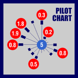
Pilot Chart dei mari italiani e del Mediterraneo, con le medie climatiche mensili, la distribuzione statistica e la rosa dei venti prevalenti.

Grafici e tavole con orario e livello di alta e bassa marea nei prossimi giorni per i principali porti italiani e del Mediterraneo centrale